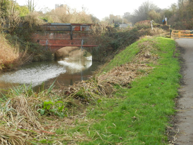
Today’s picture shows a section of Barmston Drain with the bridge being at the eastern end of Stepney Lane, off Beverley Road, Hull. The single low-arch red brick bridge and parapet is sometimes called ‘narrow bridge’; although across it is a low key industrial estate and a detached house, it was clearly never built to support heavy industrial traffic. Other bridges over Barmston Drain through the city are wider, so it would be interesting to know more of the history of this bridge.
The succession of bridges over Barmston Drain are a result of the expansion of the built-up area to the banks of the Drain, to enable cross-drain movement, they were not built across the Drain until long after it had been created. It therefore follows that the oldest of the bridges over the Drain will be at its southern end, north of this the bridges were built in succession.
To answer the question from the previous blog/post – when the engineers of the Barmston Drain were planning the project (s.p.b.) they wanted it to run direct to the Humber to achieve a greater ‘draw’, certainly at low tides. However, in the late 18th/early 19th centuries the town corporation were still demanding that all drainage channels empty into the River Hull, this to increase the volume of water scouring the Old Port (west bank of lower River Hull) as the tide ebbed. By the time the Holderness Drain was being planned this was less of an issue, partly because the early town docks had been constructed. Thus, Barmston Drain exits direct to the Humber Estuary, sandwiched between the later Alexandra Dock ant King George Dock, its pumping station standing next to Hedon Road.
The Drain above looks scruffy? to be continued.