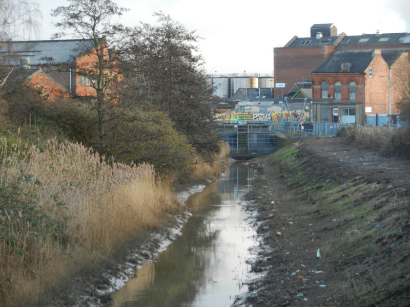
Today’s photo shows the final section of Barmston Drain before a culvert under Wincolmlee carries the water into the River Hull (the metallic silos shown are on the opposite bank of the River Hull). The scene shown is part of Hull’s old industrial corridor threading up both sides of the River. Just off picture to the right is Toogood St., so-named from the surname of a 19th century councillor rather than any other inference (see Markham, J. ‘The Streets of Hull, a History of their Names’), while due west runs Green Lane (again, a misleading name these days).
The Beverley and Barmston Drain and the Holderness Drain are two very significant green corridors through the city’s built-up area and through farmland north of the City. They were both dug for the same reason, this being to drain carr land in the central and northern parts of the Hull Valley geographical area, Hull’s close association with them only a result of the town’s built-up area expanding to the drain banks, mostly in the early and mid 20th century. The Act of Parliament, required back then before such projects could be started, for the construction of the Barmston Drain was passed in the houses of Parliament in 1798 and work involved, mostly by shovel and barrows and an army of navvies, done in 1799 and 1800. The necessary Act before the Holderness Drain was dug was passed in 1832, the work of construction being done during that decade.
Both Drains were dug deep into the boulder clay of the Hull Valley to achieve a gradient to carry the water drained off the land southwards.
There is an interesting historic reason for the two Drains ending where they do.
(to be continued).