Apologies for the break in transmission, an aching right eye became so painful that I spent last Sunday in A. and E. and the Eye Hospital, eventually decided I had severe retinal infection, then getting a supply of the relevant steroid eye drops took two days. The eye is still painful but the drops are definitely helping. Be thankful for the N.H.S., 75 years young this year, as is King Charles III, as am I.
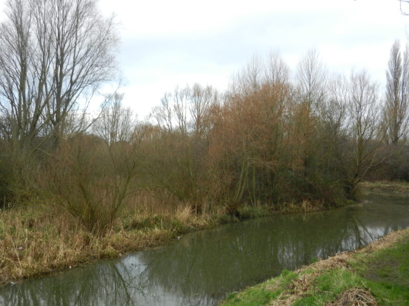
The photo above shows another section of Barmston Drain between Greenwood Av. and Hall Rd., north Hull. Here are found the only two meanders along the course of the Drain, these man-made at some point in the recent past (date?) so as to create a wetland habitat (seen here) between the old course of the Drain and this dredged section. The result has been a great success. Incidentally, the section of the drain shown is immediately east of Queen Elizabeth playing fields with Sirius North secondary school nearby.
The Drain bank is all the better for looking scruffy as the recolonisation of some natural vegetation, along with planted trees, allows wildlife to flourish. Furthermore, a drain provides a linear green corridor, this meaning that species can move from one colony to another allowing cross fertilisation. In contrast woodland plantations, or natural vegetation plantations, surrounded by arable farmland on all sides confines wildlife to an ‘island’, this resulting in weaker successive generations. There are examples of these sort of plantations on Cottingham Parks and in the parish of Barton upon Humber, Turton’s Covert being a particularly good example.
The two most recent photos show that Barmston Drain had been dredged recently as evidenced by the reeds wilting on the bank. Many people argue that too long intervals between water courses being drained helps cause flooding in residential areas. To an extent this will be true. However, drain bed mud and drain side reed beds provides valuable habitats, so it’s a difficult balance for the Environment Agency and Natural England to manage. At Barton on Humber the Haven is now a mud blocked channel with dense reedbeds, having been for centuries a transport artery. When flood prevention for the Waterside area was being discussed the result was a sturdy brick wall on either bank, dredging was not an option.