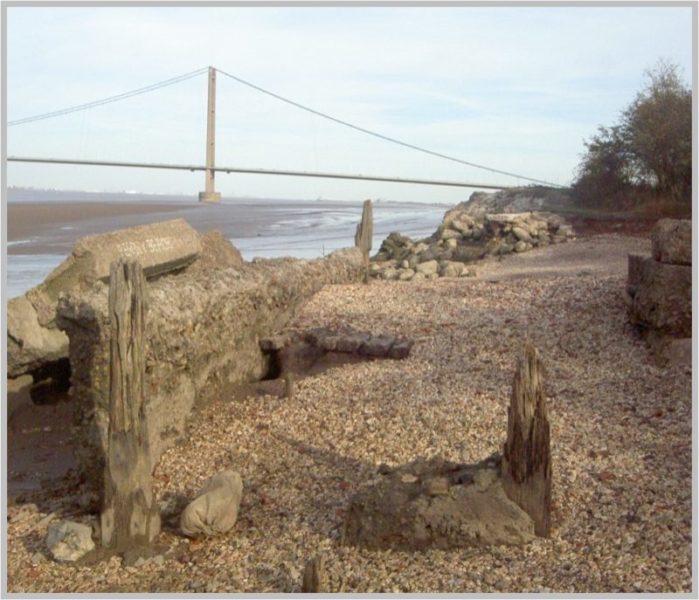
The walk alongside the Humber bank from South Ferriby to Barton on Humber is, without doubt, one of the finest walks in the Humberside region for views, landscape and flora and fauna. If not walked from South Ferriby, the walk can be accessed at a point known locally as Pebbly Beach (although the beach is mud) this with a small car parking area at the end of Far Ings Lane; the last part of the lane can be unkind to a car’s suspension. Walking then along the reinforced steel works slag promenade to a point known locally as ‘Chauder Ness’, on maps Chalder Ness where a staithe supported an aid to navigation until recently. ahead and on the right is part of the most westerly series of ‘claypits’, while on the left is the overgrown site of a once cement making factory (using local chalk) which closed over one hundred years ago. The photo above shows a part of the ‘works’ which stands beside the Humber, the remnants of a shipping jetty. Walking on the remainder of the ‘clay-pits’ are past, these are water-filled clay diggings which provided the raw material for up to 13 brick and tile making firms once sited along this stretch of the coast, each with a jetty at the end of which barges could unload coal and load bricks and rooftiles. The depth of the clay diggings varies so reedbeds have colonised the more shallow areas with open water beyond. All but one of these water bodies are now administered by Lincolnshire Trust for Nature Conservation, fishing is discouraged as are dogs on or off leads, although these can still be walker’s companions on the Humber Flood (clay) bank. Belatedly, the Environment Agency have now decided on their plans for the improved flood defences along the coast of Barton parish, unfortunately I was unable to attend the public consultation.
(to be continued)