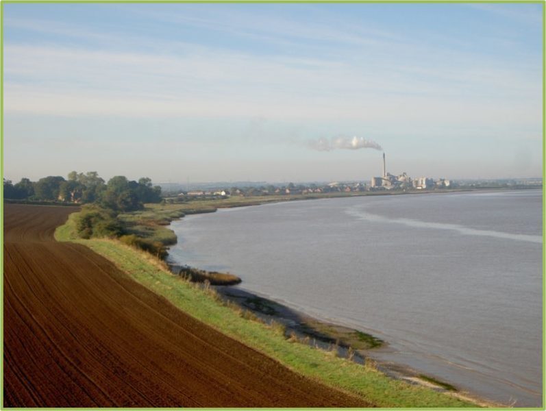
This photo shows part of the field at Cadwell looking west to Sluice Road, South Ferriby. The cement works shown is no longer in production. The grassy field side can be walked but the low cliffs here are boulder clay and readily undermined in high tides. A farm track off picture left and running parallel to the Estuary offers more secure walking.
The section of the south bank of the Humber from Winteringham Haven to South Ferriby does not allow for great biodiversity, mostly because the section of clay bank from Old Winteringham (evidence of Roman settlement) to Ferriby Sluice remains unavailable to the general public. Indeed, currently, the clay bank (old clay bank) is no longer a public right of way, and neither is the new clay bank, built after the floods of 2013, so clay bank walks out. The path(s) between South Ferriby and Barton Haven is definitely a green area. The path immediately east of South Ferriby runs through a field above the Estuary, known as Cadwell. The three/four disused chalk quarries along the way have been reclaimed by nature and it is as well that public access is limited. Nearer to Barton the public right of way passes through a farmyard and by the farmhouse this overlooking an area of managed retreat where a new inland clay bank was built and the old one breached to reduce flooding elsewhere along the Estuary. Other areas of managed retreat I have described elsewhere – Trent Falls (Alkborough Flats) and Thorngumbald Marsh; the one at Welwick Marsh is part of the north bank walk I have still to do, Patrington Haven to Kilnsea.
The marvellous section of the walk to Barton beside the nature reserves of the ‘Clay pits’, an especially important green place, I will write about next time.