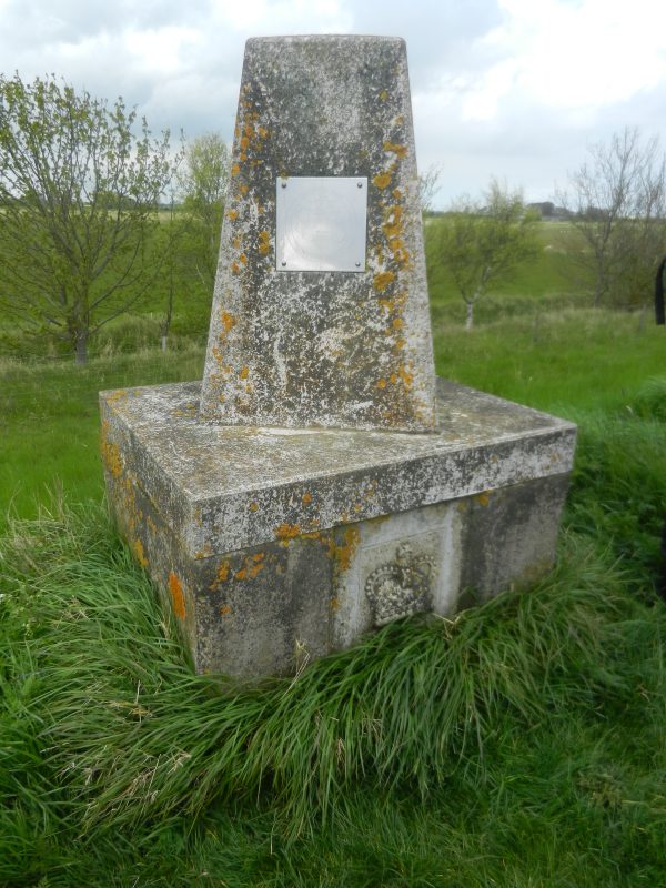
About half a mile east of Hawkins Point is a monument (‘Mon’ on O.S. map and see above). The crown shown in relief shows that it is related to the fact that the Crown owns the reclaimed land of Sunk Island On the side face of the monument is a plaque etched with the following words, ‘Crown Estate Sunk Island. The outer banks to the Humber Estuary were raised between 1983 and 1985 to 3.3m. above mean high water by the Crown Estate Commissioners’. At the foot of the plaque are the words ‘Greenwich meridian, O.S., Northern Region’. So it would seem that this monument lies on the 0 degrees line of longitude, as does southern Cleethorpes and central Hornsea. However, the O.S. Landranger map 113 shows the location of the Monument as being 32 minutes east of the Greenwich meridian, as are the other two locations; this must be related to the difference between ‘true north’ in line with the North Pole and Magnetic North which is not a static point on the Earth’s surface but moves in relation to Earth’s magnetic field. This being so the lines of longitude must be determined by the ‘True North’ while the Monument was sited according to a compass needle. I hope this is correct!
To complete our walk last Friday we walked to the west bank of the seaward end of Patrington Channel and then inland along the Channel bank to the road to Patrington Haven and on to Patrington itself.
The remaining stretch then to be walked is between Patrington Channel and Kilnsea, thus passing the massive low-tide mudflats of Skeffling Clays and Trinity Sands, these to the south of Skeffling and Easington villages, an area where once stood a medieval monastic site the exact location of which is unclear. Somewhere in this off the coastal area once stood the port of Ravenser Odd which rivalled Hull’s trade in the first half of the 14th century but which was washed away by the changed flow of tidal waters in the 1360s. Its exact location is also disputed.