Just last week I, along with two friends this time, walked a third section of the south Holderness/north bank of the Humber, this time walking east from Stone Creek to Patrington Haven – for a record of the first two sections of this region walked see two blogs/posts from back in January ’23. This time the weather was mild with occasional showers, but not as heavy as those that fell nearby, 5th May. Just to take this opportunity to record that April and May (up to the 5th) have been extremely wet and cold, this holding back by a long way the normal Easter planting of gardeners, allotment tenants and farmers. At the time of writing normal monthly temperatures have returned.
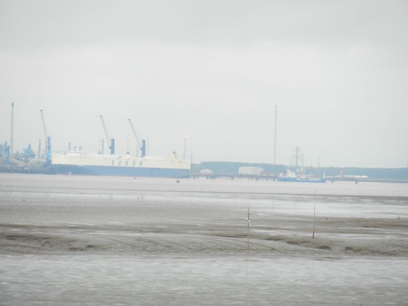
The walk outlined above was long, estimated at 11 to 13 miles, with progress sometimes slowed by thick unmown grass on the clay-bank top. Views across the Humber from Stone Creek were hazy at first following heavy overnight rain, but the air cleared by mid-morning with clear views across from the quietness of the north bank, broken only by birdcalls from the inland farmland and from waders on the broad foreshore, to the industrial and commercial business of the south bank. One fellow walker, an ex employee of Associated British Ports, commented at more than one point that, given good visibility, this was a better vantage point from which to see what was going on at the ports of Immingham and Killingholme than when on the south bank itself. Two or three bulk tanker ships were moored at the end of various jetties stretching-out from Immingham Dock front as was a multi-deck car transporter from South Korea. The industrial sites dotted along the south bank between Immingham and Grimsby were clear to see, although none of us were sure who owns which site these days and what each produces.
Of course Grimsby Dock tower was constantly in view as was Cleethorpes water tower. There was some ‘erudite discussion’ as to where the mouth of the Humber Estuary becames the North Sea coast on the south bank, Tetney Lock?, Humberstone yacht club? Cleethorpes pier? As the Lincolnshire Marsh widens in the lower Humber and down the Lincs. coast there is no clear point to define a boundary in the way that Spurn Point does on the north bank.