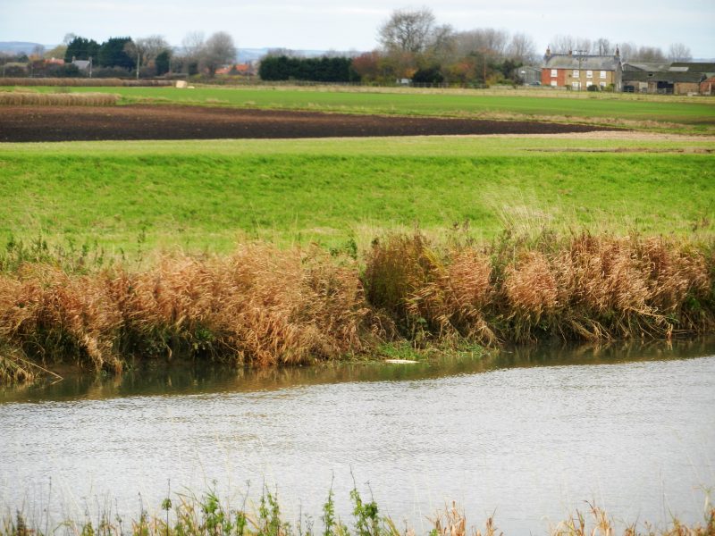
The above photo was taken from the east bank of the River Hull and looking north-west across the River towards Arram Grange farm. In the midddle ground can be seen ‘black land’, a term often used in the Fens of west Norfolk and south Lincolnshire, that is topsoil with a very high humus content derived from the natural wetland biomass prior to agricultural exploitation. As seen in the photo typically the River Hull is fringed by linear reed-beds, the main channel generally too deep for reeds to survive. In contrast, one might imagine the medieval River Ancholme (s.p.b.s) would have been far more choked by reed-beds.
Although in the Vale of Ancholme the word ‘carr’ is used to define the land that was once impenetrable wetland and is now mostly arable land (this in each successive parish) in the Hull Valley both the words ‘carr’ and ‘ings’ are used. ‘Ings’ is the term generally applied to land roughly at sea level and once wetland that is relatively near the Humber Estuary. In this location the topsoil is a result of semi-saline water from the Estuary flooding over the land. The term ‘carr’ was generally used to define low-lying wetlands over which river water often flooded, this further inland. That stated there is no sharply defined boundary, e.g. the farmland east of Bransholme is called North Carr while the land on which Kingswood has been built (and still is being built with the estate nearer still to Wawne) is known as The Ings, even though flooding has occured here from the River Hull. Of course, between Hull and Beverley flood waters could be semi-saline as the flooding is likely to occur on an flow tide. Historically, ‘ings’ land was considered to produce more lush grass than ‘carr’ land and was intensively grazed much earlier.