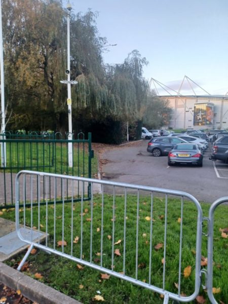
The photo above shows part of the stadium (s.p.b.) viewed from the southern entrance to the site from West Park. It also shows a planting of diverse trees near the West Park fence but which are not shown on the 1928 O.S. map.
The wedge of land, itself edged by railway lines, was never really part of West Park although the development of its facilities is recorded in Burial and Parks Committee minutes in, for example, the 1920s. It became a collection of sports grounds with an almost round cricket ground roughly in the centre (this was to become a county cricket ground). There was also another cricket ground beside the round (oval) one and a large ‘carriage shed’ (1928) alongside what is now the Paragon Station to Scarborough rail line. Also on the wedge was a bowling green, another cricket ground, a tennis ground and football ground with stands around; this may have been Hull City’s first ground (before Boothferry Park), I’m not sure of my facts here but if so the site of the City’s home ground has returned to its original site (although not exactly on the same point in the wedge). This whole site reflects the fact that by the 1920s municipal parks were increasingly expected to accommodate team sports facilities, this not being an expectation of earlier parks such as Pearson Park. Again I’m not sure, but I suspect that the land of the wedge had previously been railway owned, almost certainly the North Eastern Railway.
So what has all this to do with a green site? Will answer tomorrow.