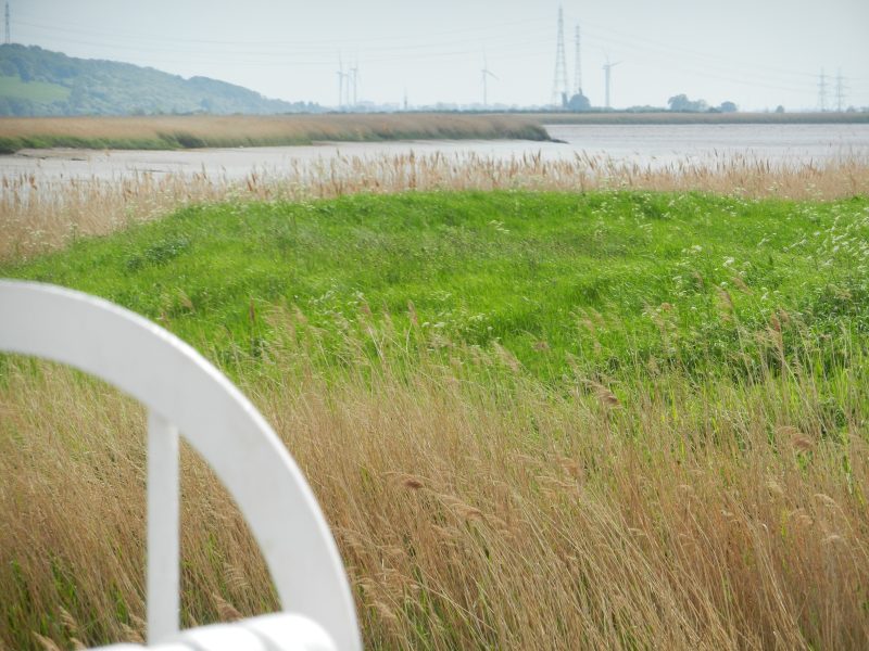
Today’s photo was taken at Faxfleet looking south. In the middle distance it shows Blacktoft Sand, an island in the upper Humber that has survived for a couple of centuries, and which is now designated a nature reserve, and is almost entirely covered by reed-beds, this binding the topsoil enabling the island to resist marine erosion. In the distance on the left is the scarp slope of the Lincolnshire Heights between Alkborough and Burton Stather while in the centre and to the right exceptionally tall pylons carry the high-tension cables over the River Trent and Keadby gas fired power station is just visible.
The third reason why no lighthouses were built as aids to navigation in the upper Humber is that there were no long-lasting deep-water channels equivalent to Whitebooth and Hull Roads channels in the lower Humber, this making the expense of building such costly fixed assets unviable. The alternative was a combination of shoreline beacons and moveable buoys.
According to the 1939 book (s.p.b.s) the Humber Conservancy Board had 18 buoys, all 10 feet diameter and eight feet high. Different names existed for different shaped buoys, the shape being of the hollow metal drum that formed the base of the buoy, and which gave it buoyancy. On top of the drum were various shaped lattice-like structures and, by 1939, on top of these were gas powered lights each visible for eight miles. The first lighted buoys were introduced to the Humber in the 1870s. Each buoy was kept in place by a strong chain and anchor bedded to the Estuary bottom and the navigation authority had at least one steam-powered small boat equipped to raise buoy anchors when they needed to be moved.
In 1939 the Humber conservancy Board were still using the same building in which buoys were stored and repaired as had been built by Trinity House and which survives today beside the River Hull just south of the original entrance to Victoria Dock.
(to be continued)