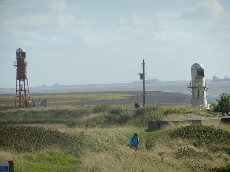
The photo above, taken earlier this year, shows the two surviving, but disused, beacons at Thorngumbald Marsh, just east of the Paull Fort complex. The view is looking south across the Estuary to the south bank and the grassy ridge centre-picture is the Humber flood bank. Just east of this point, about ten years ago, the Humber bank was deliberately breached, a further back new section of Humber bank having previously been built. The area between then flooded on high and, particularly, spring tides, this being one of the Humber’s early areas of ‘managed retreat’, increasing the area to absorb flood waters thus reducing the risk of water overtopping the flood-bank further upstream. Subsequently this area of managed retreat has become somewhat infilled with silt deposition, a fact which may well reduce its effectiveness. However, the colonising saltmarsh and reedbed has provided a habitat rich in wildlife and a bench on the new flood-bank provides an excellent vantage point.
The two metal man-made structures are beacons rather than lighthouses. The white one was the low light, the red-topped one the high light (s.p.b.s). The low light stands on rail lines (still just visible) which enabled it to be moved as the path of the deep-water channel in the Estuary changed position. Back in 1939 both beacons still contained lights and functioned as significant aids to navigation and alongside the low light was then a cottage for the keeper and his family, this, apparently, painted red while the beacon was painted white.
In the book the beacon (low light) was described as ‘an iron plated circular structure 32 feet high’, and the oil-fired light was of the same sort as that in the high light (see later).
The keeper earned £110 p.a. (in 1939) and got free coal and light (presumably oil for lamps). I do not know when the cottage was demolished.
(to be continued)