The undulating landscape of south-west Norfolk, inviting the pastime on a clear day ‘How many church steeples can you see from here?’ begs the question ‘How has this landscape been created?’
It is certainly a glaciated landscape, although on the southern fringes of the glacial advances of the last glaciation, sometimes known as the Anglian Glaciation. Glacial progress would have ’rounded’ any pre-glacial hills, and with the retreat of ice sheets unconsolidated soils would have been deposited, although this impact would have been marginal compared with areas further north. Consequently local soils can vary locally and a good farmer knew of this in each of their fields, and planned accordingly.
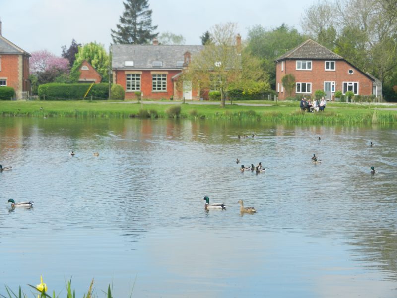
One apparent contradiction in the area is the relative frequency of surface drainage on a porous bedrock. In fact the photo above shows the pond at Boughton, lying in a spring fed hollow at just about the highest point in this village, and surrounding ones. Some how or other the water table in the porous bedrock must not function as a single broad feature, but have local variations. In my day a popular picnic site for people coming on their bikes from local villages, still so now except they now come in big four-by-fours, clogging up the lanes on their way.
Down a lane to the north of the church leading to the arable land called the ‘Common’ is a steep-sided stream which forms part of the parish boundary. Clearly this was the common land of the parish before enclosure. This stream flowing south-west passes through Boughton Fen where it has been canalised at some point in the past. Boughton Fen is the furthest extent of a branch of Fenland east of the main Fens, now a site of special scientific interest and another environmental designation, a biodiverse area now ‘discovered’. East of Stoke Ferry this stream flows into the River Wissey, a substantial watercourse flowing west across the East Anglian Heights to become, in turn, a tributary of the River Great Ouse flowing north along the foot of the scarp slope passed Downham Market and on the its mouth in the Wash north of Kings Lynn. Now the stream that forms part of Boughton parish boundary is little more than a trickle, and that poisoned by artificial fertilisers, the in the water and beside the water biodiversity all gone.
(to be continued)