The village of Boughton is situated in the agricultural area of south-west Norfolk. The middle tier of the county council government structure in Kings Lynn and West Norfolk.
Around Boughton the area is characterised as quite a dense network of villages, to the north Fincham and Barton Bendish, to the east Oxbrough (with its famous moated castle site), to the south Stoke Ferry, Wretton and Wareham and to the west Crimplesham with Downham Market beyond. An example of the classic rural settlement distribution of a village, or hamlet, every 1half to two miles.
The landscape is undulating (not flat as stated in a well known musical of the 1930s, a misnomer that seems to have endured). Rolling hills with mostly gentle gradients, so as a lad on a bike ride might enjoy some freewheel slopes, but then another steady rise so change down on the sturmy archer (three whole gears).
This then is part of the dip slope of the East Anglian Heights (a term I have only ever come across on maps), a section of the chalk hills that arc north from the North and South Downs, through Salisbury Plain and the Chiltern Hills, while to the north is the Lincolnshire Wolds and beyond the Yorkshire Wolds.
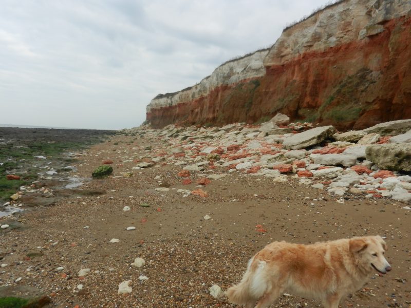
The photo above shows the chalk cliffs at Old Hunstanton at the mouth of the Wash which, like the Humber, dissects the chalk escarpment. The famous and lofty red chalk cliffs (ferrous content) face across to the scarp slopes at the southern end of the Lincs. Wolds at East and West Keal.
(to be continued)