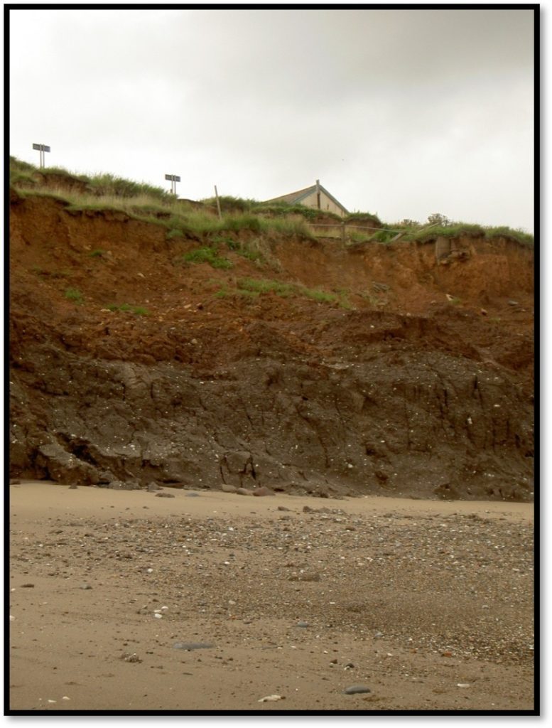
Given what has been stated already in this section, it follows that as a result of successive ice ages over the last c. five million years there may well have been successive areas of deposition in the area now called Holderness and successive periods of erosion across the area (as today). The landscape history of Doggerland and its peripheral areas would have been complex, variable according to the extent of the ice age and other factors. If then, the present ‘plain’ of Holderness had predecessors does the present receding cliff line reveal any evidence of them?
Well, of course, I don’t know, but it is certainly a viable hypothesis.
The photo above shows a section of the Holderness cliff line at Aldbrough; or, more correctly, as it was about 20 years ago, and show a bit of one of the few remaining hutments (s.p.b.) as then, all gone as now. There is a clear line of divide between two contrasting strata of clay. The upper layer is clearly unconsolidated boulder clay deposited by the retreating ice sheets of the last glaciation. The lower layer seems more compacted and of a different composition; although still clay. Could the lower layer be residual from an earlier ice age, once on the surface of that bit of Doggerland? Detailed analysis of the evidence of any plants that once existed at the top of that lower layer might prove interesting.
If this hypothesis holds any water the rate of marine erosion would be expected to vary at different points along the coast as the lower layer would be more resistant. Certainly in the photo above there is no evidence of the North Sea finding it easy to undercut this band of resistant clay, at that time at least. Also the gradient of the boulder clay of the upper layer is more shallow, suggesting that this layer is less resistant. This may have helped the owners of the cafe in the previous blog to excavate steps down to the beach! Did landscape history and the hospitality industry prove unlikely bedfellows?