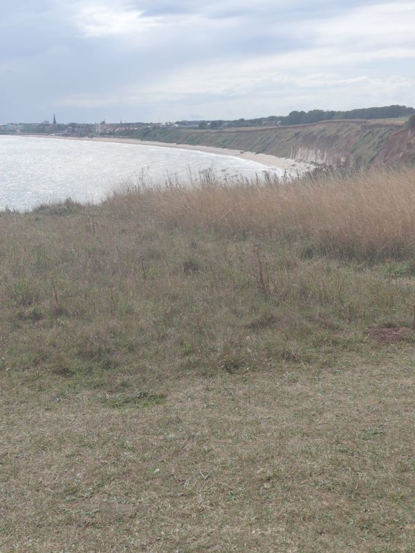
Walking east from Sewerby Hall to the cliff top, across the links, and looking south towards Bridlington can be seen a very important point in terms of the landscape history of East Yorkshire. The photo above shows that point, where the chalk base to the Post glacial boulder clay above appears to end and the cliff continues of unconsolidated clays to the south. In interglacial times this chalk cliff continued inland following the arc of the Yorkshire Wolds around to the Humber Estuary. This ancient cliff-line remains under capping of boulder clay and following the base of the dip slope of the chalk escarpment; in places its existence is hinted at in the present landscape such as at Harland Way, Cottingham, Boothferry high Road, Hessle and where the A63 trunk road broke through the formation in Hessle. This ancient cliff-line was broken by the Humber Estuary, although its remnants lie below the Estuary bed silts. The ancient cliff-line continued south of the Humber arcing round at the base of the scarp slope of the Lincolnshire Wolds; again evidenced in Pasture Road, Barton, and at various points along the spring-line settlements just above the Lincolnshire Marsh.
This cliff-line was always lower than that seen at Flamborough Head as it reflected the lower edge of the chalk strata.
So what was east of the low chalk cliff-line before the last glaciation?
(To be continued)