Holderness, in the south-east corner of East Yorkshire, is an area created by post-glacial deposition. Before the last glacial period, usually called the Devensian, the area that is now Holderness was a shallow bay in the sea that was to become known as the German Sea until renamed North Sea during the Great War. The coastline was formed by the base of the dip slope of the Yorkshire Wolds, so although it would not have been a lowland coast any cliffs would have been modest chalk cliffs. The coastal water would have been shallow and gently sloping, probably with extensive saltmarsh. If towns had existed then (and they didn’t) then Sewerby, Beverley and Hessle would have been seaside resorts, as would Barton and Immingham (the historic village, not the port) on the south bank.
The mouth of whatever ancestor of the Humber Estuary had then would have been about where the Humber Bridge now is. The then Estuary would not have been impacted by silt from coastal erosion, but, as now, it’s waters would have been tidal. The River Hull would have not then existed but the Rivers: Ancholme, Ouse, Foulness and Halton Beck may well have so any accumulation of silt would have been a result of riverine erosion.
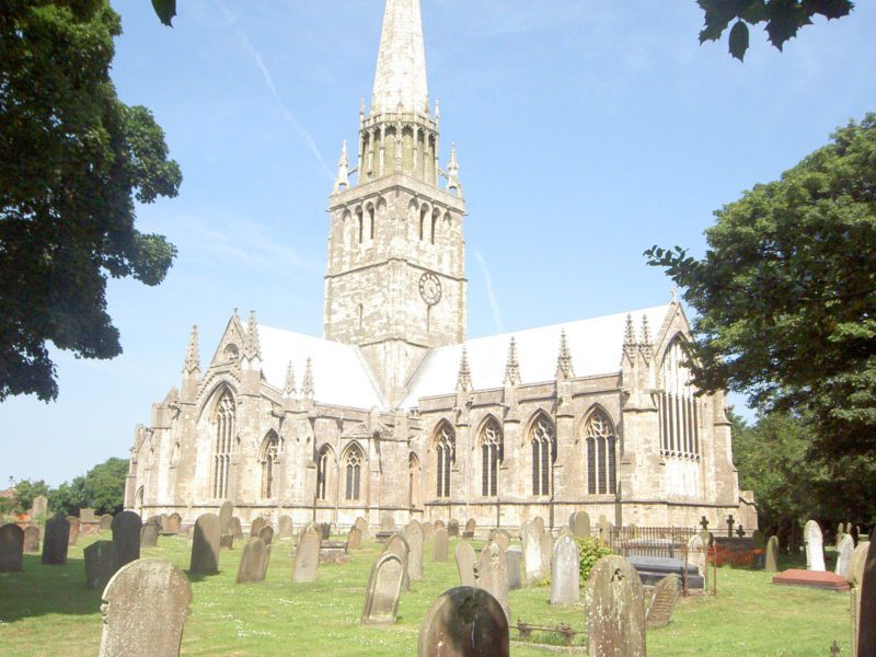
The photo above is of St. Patrick’s church, Patrington from the south-east. This majestic building was a product of a relatively rapid building programme for medieval times and is thus an almost complete example of the era of gothic architecture later called Decorated, that is of the early-to-mid 14th century. Its grandness is largely a result of the fact that Patrington was a summer residence of the Archbishops of York, although Patrington then also functioned as a port (see later).
(to be continued).