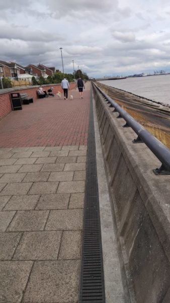
The photo above shows a section of the waterfront of Victoria Dock Village looking east towards Alexandra, king George and Queen Elizabeth Docks. Victoria Dock Village was developed in the 1980s/’90s after the Victoria Dock had been filled in as out of date and superseded by Docks further east (see above). Victoria Dock had been the first dock created east of the mouth of the River Hull from the Humber Estuary mudflats, it became especially associated with softwood timber imports from Scandinavia. The low brick wall (see above) is a modest addition to the flood defences, the main defence being the promenade wall seen on the right; interestingly this was built with a sloping face seaward giving it the same profile as had been the case with clay banks (s.p.b.s) across centuries before.
The promenade creates a pleasant walkway with some small (so far) trees planted in places and surviving! The distance of the walk from The Deep to the edge of Alexandra Dock is half to three-quarters of a mile. Where on of the streets of the estate opens onto the promenade a flood gate has been installed, this a solid metal gate, edged with a special seal, which can be shut when flooding threatens. The detached houses along the ‘front’ command high values but whether or not they can get flood insurance I don’t know.
Victoria Dock was the second of Hull’s Docks to be filled in, the earlier one being Queen’s Dock in the Town centre, now Queen’s Gardens. The lock for this Dock had been off the right bank of the lower River Hull. Dock locks allow the water level in the dock to be kept standard irrespective of the tidal range beyond.