As seen in the previous blogs/posts the traditional man-made structure to reduce flooding in lowland areas across the Humberside Region was the linear clay bank, shaped to improve its effectiveness (s.p.b.s). Sections of the Humber Lowlands are still protected by clay banks including the south coast of Holderness, the Lincolnshire Marsh, apart from the sand dunes at Cleethorpes, and the parishes of Barton, South Ferriby, Barrow and Goxhill on the south Bank of the Estuary. Indeed, at South Ferriby a new clay bank has been built running parallel, but a few yards inland, to the earlier one that was oner-topped in 2013, this somewhat blocking the views the houses along Sluice Road previously had of and across the Humber.
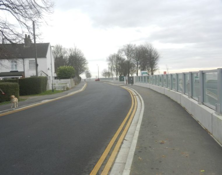
In the more built-up areas along the Humber the Environment Agency have opted for designs of sea-walls in the improved flood defences post 2013, this reasonable given the built-up nature of the immediate Humber edge. The photo above shows a section of the new sea-wall at Hessle Foreshore near the north tower of the Humber bridge. Here a sturdy concrete base provides footing for reinforced glass panels held between sturdy verticals. The height of the new sea-wall is about five feet and should help protect this area which was severely flooded in 2013. The same type of ‘wall’ was built at Paull to the east of Hull and was the first post-2013 sea defence to be built
(to be continued).