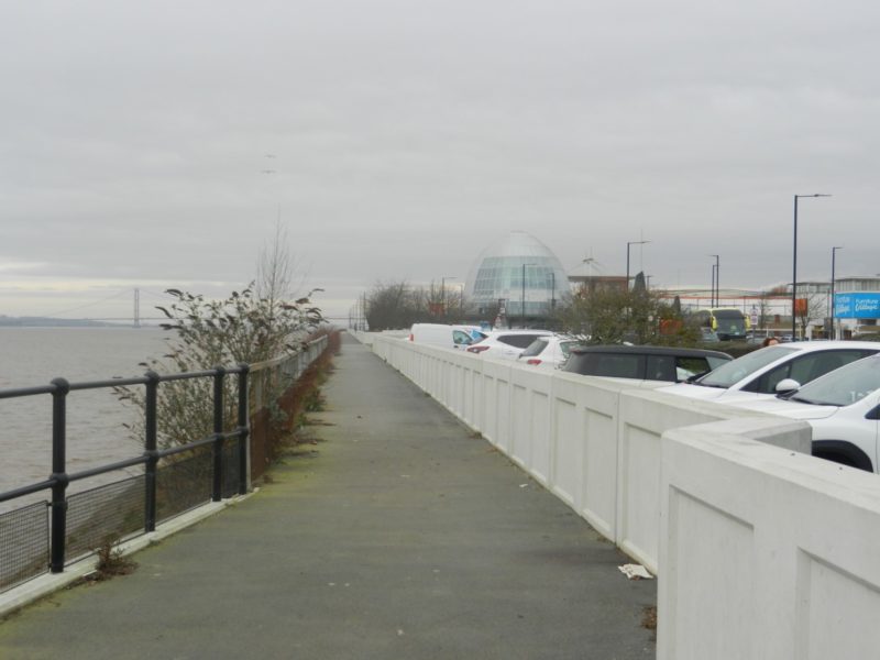
The photo above shows a section of the relatively new ‘sea-wall’ at St. Andrews Dock, this for almost 100 years a purpose-built dock for Hull’s deep-sea fishing fleet but filled in in the 1960s and ’70s with the demise of the fishing industry to be replaced by a retail park, although the original buildings around the lock, now very derelict and the subject of ill-feeling between the City Council and the landowners, await redevelopment. This type of sea-wall does not include glass panels and is thus only about four feet high, nevertheless it does somewhat obscure the view from the retail park across the Humber Estuary to the south bank beyond. As may just be seen on the left of the picture the Dock and associated buildings was originally protected from the waters of the Estuary by a massive stone-block wall which still stands well above high-tide level.
A bit further east in an area of the City known as the Pier, as here was the wooden structure alongside which ferry boats from New Holland (itself with a pier on the south bank) moored before the completion of the Humber Bridge, the new flood defences are of a similar type, the whole area having been redesigned to created a pleasing, much visited area.
The flood defence of Hull’s Humber bank Docks to the east (Alexandra Dock, King George Dock and Queen Elizabeth Dock) and the remaining Dock west of the Pier (Albert and William Wright Dock) are similarly protected to St. Andrews.
Historic and present day barriers to the free-flow of tidal action over littoral (coastal) areas is, and has been, a calculated risk by humans to ‘develop’ such areas and challenge the natural order. This process has always been defined by biased terminology which conveys a sense of virtuous action in the face of hostile natural forces. A classic example is use of the term ‘reclaim’ land, as if human action ever had it in the first place! A more appropriate term would be to ‘modify’ Nature – but then modifications bring consequences.
(to be continued).