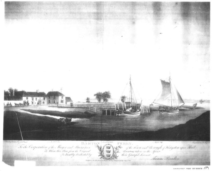
The sketch above dated 1805 shows Waterside House and stables in the parish of Barton on Humber alongside the mouth of Barton Haven flowing into the Humber. The two sailing boats are sailing to/from two jetties, one serving the Barton to Hessle ferry, the other the Barton to Hull ferry. A vague image of the north bank of the Humber Estuary (Hessle) may be seen. Waterside House, orientated east/west, survives, the remainder of the building complex long gone. In front of the stable block is shown a four-horse stage coach, this being an embarking/disembarking point on the East Riding to London stage coach route. Other Georgian buildings in Barton were once staging inns. The three crowns/coronets emblem had been adopted by Hull Corporation long before the 19th century.
The clay banks of the Barton Haven can be seen.
The history of flooding on Wallingfen (s.p.b.s.) is not something I have researched but often flooded it was.
As regards the Humberhead Levels (the Vale of Ancholme (s.p.b.s) I have recently read a book entitled ‘Yorkshire’s Forgotten Fenlands’ written by Ian Rotherham (Wharnecliffe Books, 2010). It deals with many things including the history of medieval flooding. As most of this region is outside the immediate Humberside area I am not listing some of the evidence here. It is basically a vast lowland area between the head of the Humber and Doncaster.
As regards the Vale (valley of) the River Ancholme on the south bank (s.p.b.s) there has been considerable research into the history of flooding from local and national records, this mostly by the late Mr. Cleary of South Ferriby. His widow has allowed me to take over some of his research.
(to be continued)