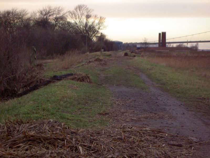
The above photo was taken on 7th December, 2013, two days after the great flood resulting from the combination of a spring tide and coastal surge happening at the same time in the Humber Estuary. The view is looking west from a point east of the working clay tile works east of Barton’s coastal nature reserve looking towards the southern anchor of the Humber Bridge seen in the middle distance. As can be seen, most of the damage to the clay bank at this point was done on its landward side, the gentle slope of the seaward side being undamaged while the steep landward slope being more readily eroded by the faster flowing water down the steep slope as well as a probable back eddy as the water hit level ground.
The clay bank along the southern coast of Holderness on the north bank of the Estuary (s.p.b.s) was similarly damaged. Our knowledge of the history of flooding in this area is dependent upon references in surviving documents and writings. One of the main sources of evidence is the Meaux Abbey Chronicle (s.p.b.) which records an ‘inundation of Humber’ in 1253 as far inland as Cottingham and resulting in loss of buildings, men and cattle. Cottingham, originally an Anglo-Saxon spring-line settlement once claimed to be the ‘largest village in England’ and now a suburb of Hull, is five miles inland of the Humber north bank today. Another event recorded in the Chronicle is that between 1310 and 1339 33 acres at Pensthorpe were ‘swallowed up by the Humber’. Pensthorpe was a site on what is now Sunk Island although its exact location is unknown. A later reference to Pensthorpe in the late 14th century records it as lost to the Humber.
(to be continued)