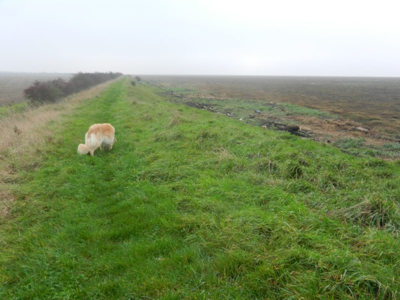
The photo above shows a section of clay bank along the southern coast of Holderness (s.p.b.s), it is in the area of Cherry Cobb Sands, this a western extension of Sunk Island. This is clearly not a medieval clay bank because of its size and because the history of this whole area is complex with the modern reclamation of the tidal flats of the south Holderness coast dating only from the 18th century. This clay bank was almost certainly heightened after the 1953 floods along the east coast of England and is bound by deep-rooted grasses. It examples the characteristic clay bank profile of a gentle slope seaward (to the right in the photo) and the steeper inland slope (left).
Although not writing specifically of the Humberside region the 13th century Benedictine monk based at St. Albans Abbey Matthew Paris (or Matthew of Paris, this misleading as neither he nor his family had connections with the French City), wrote in one of his manuscripts (Historia Anglorum, latin) that has survived of floods along the east coast on 12th November 1236 where the waters ‘drowned a multitude of men, destroyed flocks of sheep and herds of cattle, tore up trees and overturned houses’.
This could well have been a direct reference to the south Holderness coast as the fertile estuarine silt soils, once protected by a clay bank, were best suited to pasture with the wool of English sheep then being the country’s most valuable export. It was the Cistercian Abbey at Meaux (three miles east of Beverley and on the borderlands between the River Hull floodplain and Holderness) which ‘pioneered’ the development of the south Holderness Humber floodplain in the 13th century.
What of other floods in this region and who built and maintained the clay banks back then?
(to be continued).