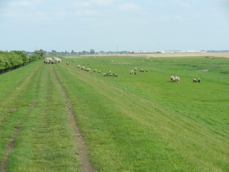
Throughout the Middle Ages and beyond the basic form of flood defence was the linear ‘clay bank’, a potentially misleading name as the soil that was piled-up would have often been estuarine silts. If available, the ‘bank’ might have been reinforced by turves. The tidal range in the Humber Estuary is second only to that in the Severn Estuary in the south-west, this meaning that on an ebb tide there was both space and time to work at the ‘bank’ before the next high tide. The section of clay bank shown above is, of course, relatively modern but it does example the traditional profile of a clay bank that being a gentler slope facing the incoming tide compared with a steeper slope facing inland, the Estuary above being to the right. Once the ‘bank’ had settled a gently flowing high tide would lap against the gentle slope causing no damage; the problem came in times of storms and/or coastal surges. Here the increased volume of water at high tide might simply flow over the clay bank, this likely to damage and make unstable the flood bank as well as flooding whatever land use the land inland had been given over to. Certainly on the north bank the most common use made of this land was pasture, the estuarine silts being very fertile once separated from the impact of daily tidal wash.
The section of relatively modern clay bank seen above is located west of Brough (buildings in the distance) near the head of the Estuary at Trent Falls.
(to be continued).