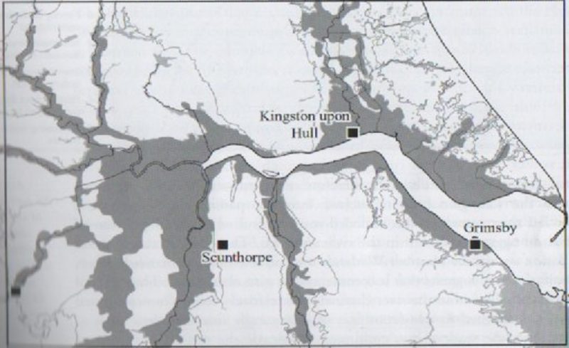
The story of the Estuary’s wetlands, past, present and future is both interesting and very relevant. The extent of the wetlands, as seen in black in the map above, is second only to that of the Fens of Norfolk, Lincolnshire (Holland) and Cambridgeshire. Moving from right to left across the north bank the areas at, or just above, sea level are; the south Holderness coastline (Sunk Island and Cherry Cobb Sands), the lower flood plain of the River Hull on which Kingston upon Hull stands, Wallingfen (immediately west of the Yorkshire Wolds, the south-east corner of the Vale of York), the lower River Ouse flood plain and the lower flood plain of the River Trent (this huge area with the overall name of the Vale of Axholme), and then along the south bank of the Humber Estuary from left to right the linear Vale of Axholme (stretching south almost to Lincoln) and , finally, the Lincolnshire Marsh stretching along the coastal plain of the Estuary from Barton on Humber to south of Grimsby and beyond.
Although much of these areas has been reclaimed from the sea over historic time the density of population, agriculture, industry and other land uses require massively expensive flood protection measures. Such is progress.