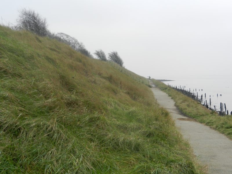
The above photo shows a section of the southern rampart of Paull fort as well as a section of the coastal footpath. Paull fort is on the list of Heritage at Risk Register sites (s.p.b.s). The footpath shown is accessed either from the village itself by walking past Paull lighthouse (as was) or down a rough track that starts beside a derelict single-storey gatehouse cottage that once was the entrance to the site of a large house that once existed on the foreshore. Again p. 646 of Pevsner (s.p.b.) is a good source of evidence. Until relatively recently the fort/battery was often open to the public (although I only went in once) and attractions included a big transport aircraft of the 1950s previously sited at the Museum of Army Transport, Beverley, the site now a shopping complex. The aircraft was, I think, manufactured at Brough. Paull fort/battery is currently disused and the buildings within the site deteriorating rapidly.
Page 646 (see above) tells us that the very first fortification on the site was a gun battery established in 1542. This would have been a fraction of the size of the present complex but sited there to command a view to the left and right along the lower Humber and an emplacement to deter invaders. The view was a result of the site being at the southernmost end of the morainic ridge previously mentioned. The date 1542 suggests that it was somehow related to Henry VIII’s Northern Progress of 1541, during which he did order the building of defences for Hull east of the lower River Hull, this resulting later in the building of a massive curtain wall through the parish of Drypool incorporating three round forts. This was enlarged to form what was called the Citadel the following century which was only demolished when the Victoria Dock was created in the 1850s. The south blockhouse of this site has been recently excavated by archaeologists and there are plans to create an information site near the Deep.
(to be continued)