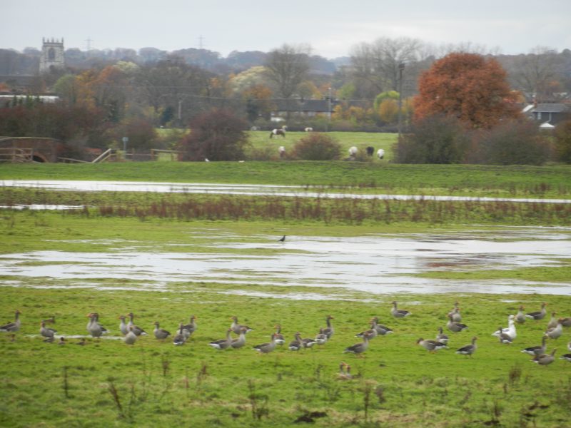
The photo above shows a section of the River Hull’s floodplain between the River’s west bank and a section of the Beverley and Barmston Drain to the west of the River in the middle distance, this photo taken in November 2016 with geese (possibly migrating) appreciating the standing water. Across the winter of 2016-2017 I walked the bank(s) of the River Hull from mouth to source in a series of sections. As with various other projects this is yet to be written-up. For most of the course of the River both banks are public rights of way, many side drains are bridged but the entrance to Leven Canal and the mouth of North Frodingham Beck block progress on the east bank. For most of the River’s course the Beverley and Barmston Drain runs parallel on the west side with the distance between the two water courses varying from a few hundred yards (as above) to very close, as, for example, at the entrance to Beverley Beck.
I have not measured the length of the Rivers Hull and Ancholme (s.p.b.) on the map but would imagine them to be of similar length. Of course before the piecemeal canalisation of the River Ancholme between the 17th and 19th centuries the course of the River would have been much longer around the winding meanders of the River’s ‘old’ course.
As with the River Ancholme (s.p.b.s), the River Hull and its floodplain lie between two geophysical areas the dip slope of the Yorkshire Wolds to the west and the undulating ‘Plain’ of Holderness to the east. For most of the River Hull’s course it is nearer to the latter than the former. The meanders of the River Hull were not as winding as those once of the Ancholme and for centuries the flood alleviation tactic was the raise the River’s banks and to keep the River’s main channel free of obstructions and reedbeds.