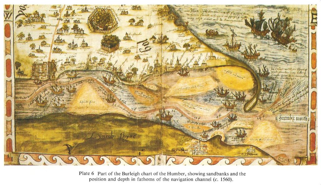
The picture above shows part of the first known navigational chart of the Humber compiled by Lord Burleigh, or more likely his workforce, c.1560. It clearly shows the coastline of south Holderness before the reclamation of Cherry Cobb Sands and Sunk Island – in doing so it shows the Humber Estuary lapping-up to the southern edge of the villages of Patrington, Ottringham and Keyingham with a ship having navigated a channel up to the ‘port’ at Patrington (St. Patrich’s church shown with the needle spire topping the crossing tower of the church). It also shows the deep-water channel crossing the Estuary diagonally (lower centre), later to be called ‘Hull Roads’ and an important factor in explaining the rise in importance of the port at Kingston-upon-Hull.
Lord Burleigh’s map focussed on the East Riding which is why little detail is shown for north Linconshire except for a representation of the church of St. James’, Grimsby and the part late-Saxon church at Clee (inland from Cleethorpes today). In fact Burleigh’s map is very instructive in terms of the history of regional church buildings, he did not have a standard icon for parish churches but usually showed them, albeit on a very small scale, as they then were. Further up the Holderness coast are shown some communities since lost to coastal erosion.
Recently did, for the first time in ages, a reasonable walk; a circular route from Paull walking the south bank of Hedon Haven up to the underpass of the bypass, followed some municipal parkland with mature hawthorn hedges just coming into leaf (as at Oak Road playing fields), over the old main road and through to the north side of town following a green corridor. Then to Market Green, round St. Augustine’s church to Market Place (one stall only but still lock-down). Out of town south and followed Thorngumbald Drain to the relatively new clay-bank of the area of managed retreat east of Paull. To Paull church, back to the Humber bank and so to the end in Paull village. Will say bit more about this next time.